Manaslu Circuit Trek
Max Altitude
5,106m
Duration
15 Days
Difficulty
Hard
Best Season
Spring & Autum

Start Point
Kathmandu

Group Size
2-15 People
Trip Overview
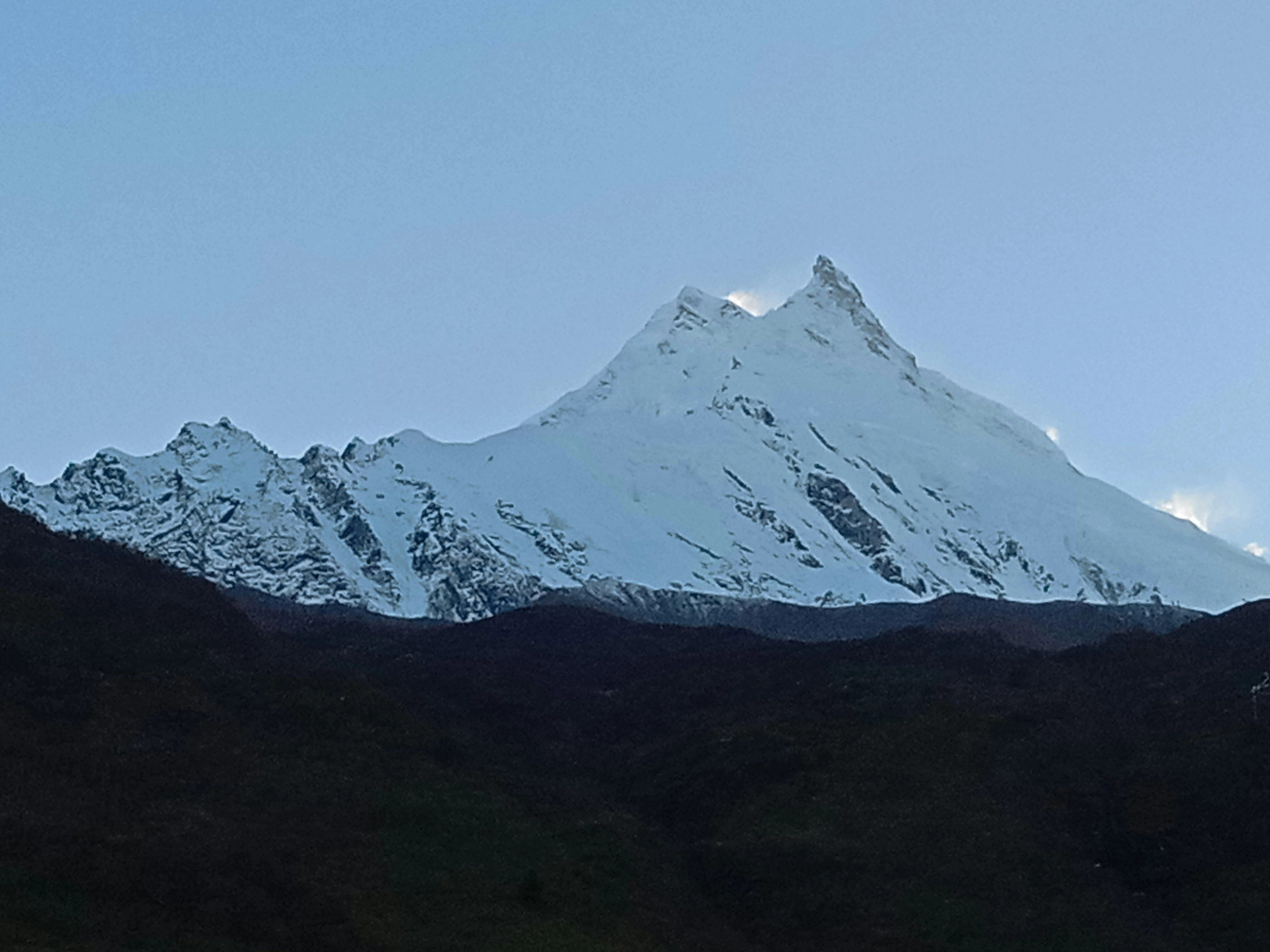
The 15-Day Manaslu Circuit Trek follows a dramatic route around Mount Manaslu through river valleys, forested hillsides, traditional settlements and high-altitude landscapes. Reaching 8,163 metres, Manaslu is the eighth-highest mountain in the world, and the circuit beneath it offers a rewarding alternative to Nepal's busier trekking regions.
Beginning in Kathmandu, the journey continues by road to Machhakhola. From here, the trail gradually climbs through Jagat, Deng, and Namrung to Lho Bazaar. The lower section of the route passes cultivated terraces, narrow valleys, and settlements connected by mountain paths. As the trek gains elevation, the landscape becomes increasingly alpine, with clearer views of the surrounding peaks and stronger influences of Himalayan Buddhist culture.
One of the most memorable parts of the route is the approach to Samagaun at 3,530 meters. The village provides an important acclimatization stop before the route continues towards Samdo and Dharamsala. An additional day in Samagaun allows the body to adjust to the elevation and gives trekkers time to rest before entering the highest section of the journey.
The main challenge is crossing Larkya La Pass at 5,106 meters. This is the highest point of the trek and requires an early start, steady pacing, and suitable weather conditions. The crossing involves a long day of approximately 8–9 hours, followed by a descent to Bimthang at 3,720 metres. From Bimthang, the trail drops towards Gowa and Tilije, where the route exits into Annapurna Conservation Area territory before the return journey to Kathmandu.
Accommodation during the trek is provided in local teahouses or lodges. Breakfast, lunch and dinner are included on the trekking route. An experienced, government-licensed guide manages the daily schedule, while porter support helps reduce the physical burden of carrying equipment.
This itinerary is best suited to active travellers comfortable walking for several consecutive days. Previous high-altitude trekking experience is helpful but not specifically required. Good preparation, appropriate clothing, and comprehensive travel insurance are strongly recommended.
Because the Manaslu region is a government-restricted area, this trek requires a minimum of two trekkers travelling together with a licensed guide; solo trekking permits are not issued for this route. Hatti Hatti Treks combines local knowledge with careful logistical planning to operate this journey responsibly, arranging the Restricted Area Permit, conservation area permits, guide and porter support, ground transportation and trekking accommodation so travellers can concentrate on the trail and the changing Himalayan scenery.
Accommodation & Food standards

Standard
- Teahouse/Lodge accommodation
- Basic but comfortable rooms

Premium (Comfort)
- Upgraded lodges or boutique hotels (where available)
- Private rooms and better facilities

Meal Types
- Breakfast
- Lunch
- Dinner
Day-By-Day
Your 15-Day Itinerary
A Hatti Hatti Treks representative will meet you at the airport and transfer you to your hotel in Kathmandu. After checking in, rest following your international journey. The trekking team will assist with the necessary preparations and provide relevant information about the route, equipment and the upcoming road journey.
Max Altitude
1,400 m
Accomodation
Four-star hotel in Kathmandu
Meals
Not included
Leave Kathmandu and begin the approximately 8–10 hour overland journey to Machhakhola, the trek's starting point. The drive takes you into Nepal's rural hill country, following winding roads through settlements, river valleys and cultivated landscapes. On arrival, check into a local lodge and prepare for the first full day of trekking.
Max Altitude
930 m
Accomodation
Teahouse in Machhakhola
Meals
Breakfast, lunch and dinner
Begin the approximately 6–7 hour walk along the river valley towards Jagat. The trail follows a varied route through small settlements and narrow sections of the valley, with a mixture of climbs and descents. Jagat is an important settlement on the route and serves as the overnight stop.
Max Altitude
1,340 m
Accomodation
Teahouse in Jagat
Meals
Breakfast, lunch and dinner
Continue north from Jagat on an approximately 6–7 hour trek, following the trail deeper into the Manaslu region. The day includes changing terrain, river crossings and steady sections of ascent. As you approach Deng, the surrounding landscape becomes more enclosed by steep hillsides and forest.
Max Altitude
1,860 m
Accomodation
Teahouse in Deng
Meals
Breakfast, lunch and dinner
The trail climbs steadily from Deng towards Namrung during an approximately 6–7 hour trek. Forested sections, mountain settlements and changing vegetation mark the transition into a higher Himalayan environment.
Max Altitude
2,630 m
Accomodation
Teahouse in Namrung
Meals
Breakfast, lunch and dinner
Leave Namrung behind and continue through peaceful forests and traditional stone villages as the trail climbs gradually toward Lho. Along the way, enjoy impressive views of Manaslu and the surrounding Himalayan peaks before reaching this beautiful mountain village, known for its monastery and rich Tibetan Buddhist culture.
Max Altitude
3180 m
Accomodation
Teahouse/lodge
Meals
BLD
Continue towards Samagaun on an approximately 6–7 hour trek. Samagaun is one of the principal settlements on the upper section of the Manaslu Circuit, and traditional architecture and Buddhist cultural features become increasingly visible along the route. Settle into the teahouse for a two-night stay.
Max Altitude
3,530 m
Accomodation
Teahouse in Samagaun
Meals
Breakfast, lunch and dinner
Spend an additional day in Samagaun to help your body adjust to the higher elevation, ahead of the journey towards Samdo, Dharamsala and Larkya La Pass. The day can be used for rest or a suitable acclimatization walk, depending on conditions and the guide's assessment.
Max Altitude
3,530 m
Accomodation
Teahouse in Samagaun
Meals
Breakfast, lunch and dinner
Leave Samagaun and continue on an approximately 4–5 hour trek through a more exposed high-altitude landscape towards Samdo, the final main settlement before the approach to Larkya La Pass.
Max Altitude
3,870 m
Accomodation
Teahouse in Samdo
Meals
Breakfast, lunch and dinner
Continue on an approximately 4–5 hour trek to Dharamsala, the staging point for the Larkya La crossing. The route enters a colder and more remote landscape where services and accommodation become basic. The guide will assess trail and weather conditions before confirming the plan for the pass.
Max Altitude
4,460 m
Accomodation
Teahouse in Dharamsala
Meals
Breakfast, lunch and dinner
This is the longest and most demanding day of the trek. Begin early for the approximately 8–9 hour journey and climb gradually towards Larkya La Pass, the highest point of the trek. Cold temperatures, strong winds, snow or ice may make the crossing more difficult.
After reaching the pass, begin the long descent towards Bimthang, requiring concentration on frozen or snow-covered ground.
Max Altitude
5,106 m
Accomodation
Teahouse in Bimthang
Meals
Breakfast, lunch and dinner
Descend from the high-altitude environment around Bimthang towards the greener landscapes of Gowa during an approximately 6–7 hour trek. After the demanding pass crossing, today offers a welcome change in scenery and warmer conditions.
Max Altitude
3,720 m
Accomodation
Teahouse in Gowa
Meals
Breakfast, lunch and dinner
Complete the final short section of the trek from Gowa towards Tilije, approximately 45 minutes to 1 hour. After reaching the road-access point, meet the vehicle and begin the approximately 9–10 hour drive back to Kathmandu. On arrival, transfer to your hotel.
Max Altitude
2,500 m
Accomodation
Four-star hotel in Kathmandu
Meals
Breakfast
Enjoy a free day to rest, organise belongings, purchase souvenirs or explore Kathmandu independently. Optional sightseeing can be arranged separately if desired. This day also provides limited flexibility following the road journey from the trek.
Max Altitude
1,400 m
Accomodation
Not included
Meals
Not included
Your Manaslu Circuit Trek concludes today. A Hatti Hatti Treks representative will transfer you to the airport according to your international departure schedule.
Max Altitude
1,400 m
Accomodation
Not included
Meals
Not included
We Accept




What's Covered
Inclusion And Exclusions
What's Included
- Airport pick-up and drop-off in Kathmandu
- Two nights at a four-star hotel in Kathmandu
- Tourist bus or private vehicle transportation between Kathmandu and Machhakhola
- Return transportation from the trek to Kathmandu
- Teahouse accommodation during the trek
- Breakfast, lunch, and dinner during the trek
- Experienced, government-licensed trekking guide
- Porter service, subject to the confirmed baggage allowance
- Manaslu Restricted Area Permit (RAP)
- Manaslu Conservation Area Permit (MCAP)
- Annapurna Conservation Area Permit (ACAP)
- Guide and porter salaries, meals, and accommodation
- Insurance for the guide and porters
- Group medical and first-aid kit
- Applicable government taxes and service charges
What's Not Included
- International airfare
- Nepal entry visa fees
- Comprehensive travel insurance
- Emergency evacuation coverage
- Additional Kathmandu accommodation outside the two scheduled hotel nights
- Accommodation and meals on Day 14 unless separately arranged
- Lunch and dinner in Kathmandu
- Personal trekking equipment and clothing
- Hot showers during the trek
- Wi-Fi and internet charges
- Battery and device-charging fees
- Personal expenses
- Alcoholic beverages
- Soft drinks and bottled water
- Tips for the guide and porters
- Excess baggage or additional porter services beyond the confirmed baggage allowance
- Costs resulting from weather, route changes or itinerary modifications
- Expenses caused by illness, early withdrawal or unforeseen circumstances
- Costs resulting from changes requested by the participant
- Kathmandu sightseeing transportation, city guide or entrance fees unless separately arranged
- Services not specifically mentioned under Cost Includes
Common Questions
FAQs
This package runs 14 days, including arrival in Kathmandu, road transportation, trekking, an acclimatisation day, a free day in Kathmandu and final departure.
The highest point is Larkya La Pass at 5,106 metres.
It is a challenging trek involving consecutive walking days, high altitude, basic accommodation and a demanding 8–9 hour pass crossing.
Yes. Day 7 is reserved for acclimatization in Samagaun at 3,530 metres.
The package includes two nights of hotel accommodation in Kathmandu (Day 1 and Day 12) and teahouse accommodation during the trek, with breakfast, lunch and dinner provided throughout. The Day 13 free day and Kathmandu meals outside the trek are not included.
The package includes the Manaslu Restricted Area Permit (RAP), the Manaslu Conservation Area Permit (MCAP) and the Annapurna Conservation Area Permit (ACAP) — required because the route exits into Annapurna Conservation Area territory near Bimthang and Dharapani. A TIMS card is not required for this route.
Yes. Travel insurance is essential and must cover high-altitude trekking, medical treatment and emergency evacuation. It is not included in the package.
Spring and autumn generally offer the most suitable conditions. Weather at Larkya La can still change quickly, even during the main trekking seasons.
No. The Restricted Area Permit requires a minimum of two trekkers travelling together with a licensed guide; solo permits are not issued for this route.
The guide will assess the weather and trail conditions. If the crossing is unsafe, the itinerary may need to be delayed or changed. Expenses arising from unforeseen circumstances are not included.